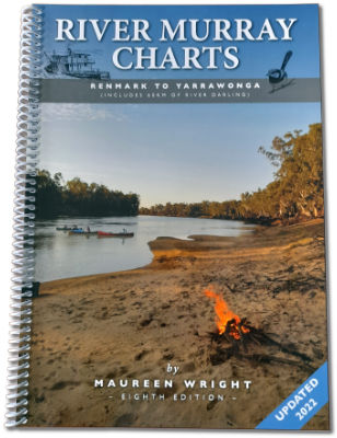
The only navigation chart of the River Murray from Renmark in South Australia to Yarrawonga in Victoria...
For travellers on the river Murray this book is an essential tool, showing reefs, snags, sand bars, groynes, fuel points, locks, kilometre signs and camping areas.
The Charts are compiled by Maureen and Barry Wright who have travelled this 1422 km stretch of river eight times over 40 years. The book has 47 pages of navigation charts as well as history, boating and fishing regulations and instructions on how to navigate the 8 locks and 11 bridges in this section.
River Murray Charts has sold over 60,000 copies in 8 editions and won two judges’ commendations in the SA State Tourism Awards in 1992 and 1993.
The current 8th edition of River Murray Charts was prepared after a revision trip from Yarrawonga to Renmark in March/Aril 2013. It is available from our ONLINE SHOP using Paypal or credit card.
To check details and contents go to our CHARTS page.
GPS readings for all kilometre signs, groynes and some reefs are available free from the GPS page.
If you are planning a trip, the 8th edition is recommended. Check out our UPDATES before setting off.
The Story of River Charts
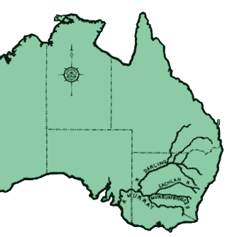
In the late 1800's approximately 4,000 miles of the great Murray Darling river system was continuously navigable....at least for part of the year, depending on the flow of water down these systems.
The River Murray is Australia's major river and is still continuously navigable for approximately 1,200 miles or 1,986 kilometres, thanks to 11 locks and weirs and four barrages between the Murray mouth and Yarrawonga.
Old river men used hand drawn charts to guide them. Until 1975 there were no commercial river charts available for the River Murray.
Barry and Maureen Wright spent 14 months cruising from Murray Bridge to Yarrawonga in 1973 and 1974 and from this trip resulted a publication which was the first of its kind.
River Murray Charts is a book of 47 pages of navigation charts, designed very much as they were in the days of the Murray paddle steamers. The book was first sold in 1975 and since then River Murray Charts has become the bible of the river between Yarrawonga in Victoria and Renmark in South Australia.
In January 2016 Maureen was awarded an Order of Australia Medal for services to cartography and to community.
Phone : Maureen 0417 085 086, Barry 0408 602 389